Today I went to Portobello Library “just to look.”
You know how that goes.
I walked in thinking I’d spend twenty minutes, maybe borrow a book, maybe behave like a normal person. Instead I fell straight into the kind of rabbit hole I secretly live for: old maps, strange labels, neat little cartographic decisions that feel like poetry dressed up as administration.
And suddenly my Portobello/Joppa walk had ancestors.
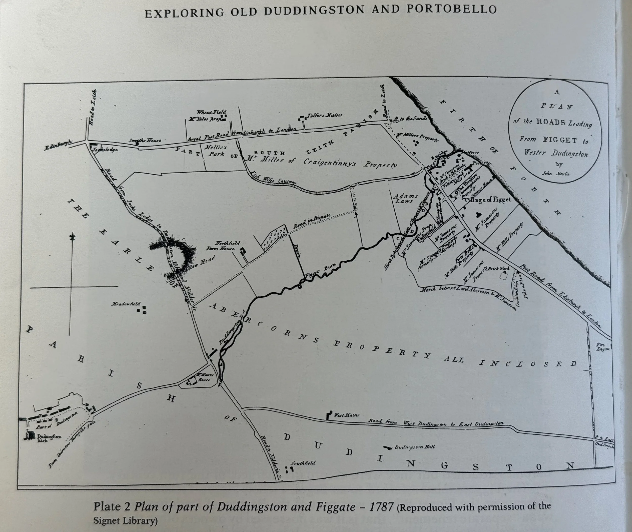
One of the first things that hit me was a tiny shock of time: Portobello wasn’t always Portobello—at least not in the way the city now assumes it has always been there. In one map, the logic is so blunt it becomes hilarious: all roads, and no Portobello. Just lines, burns, old ways, and the sense of a landscape being organised long before a seaside neighbourhood becomes a destination.
There’s something almost theatrical about these documents. They aren’t just maps. They’re beliefs. Someone decided what counted as a road, what counted as a boundary, what deserved a label. Someone drew a burn like a sentence and gave it authority. Someone placed a compass rose and said: this is how you should orient yourself.
I found myself grinning at the titles.
“Old Ways — and Means.”
As if the map is admitting it’s not neutral. It’s a method.
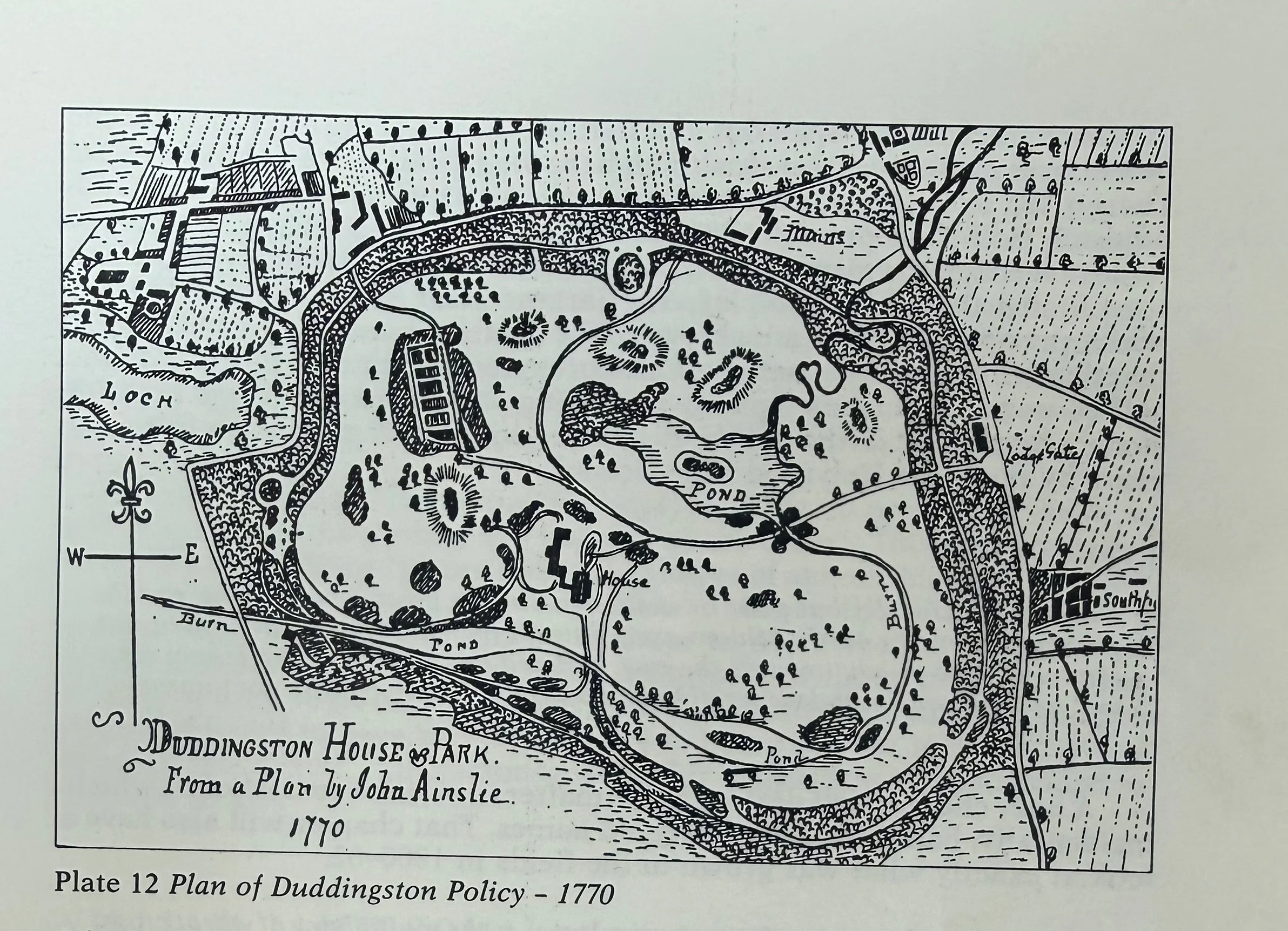
Then there’s this gorgeous plan-like view — a neat little world of ponds, lochs, garden forms, and careful edges. It’s the kind of drawing that makes you realise mapping can be intimate. It’s not only about getting somewhere. It’s about controlling what gets seen, what gets named, and what gets remembered.
And in the middle of it all: Duddingston, Figgate, Brunstane, Milton Road, the burns.
Places I pass without thinking—suddenly drawn like they matter deeply. Which, I suppose, they do.
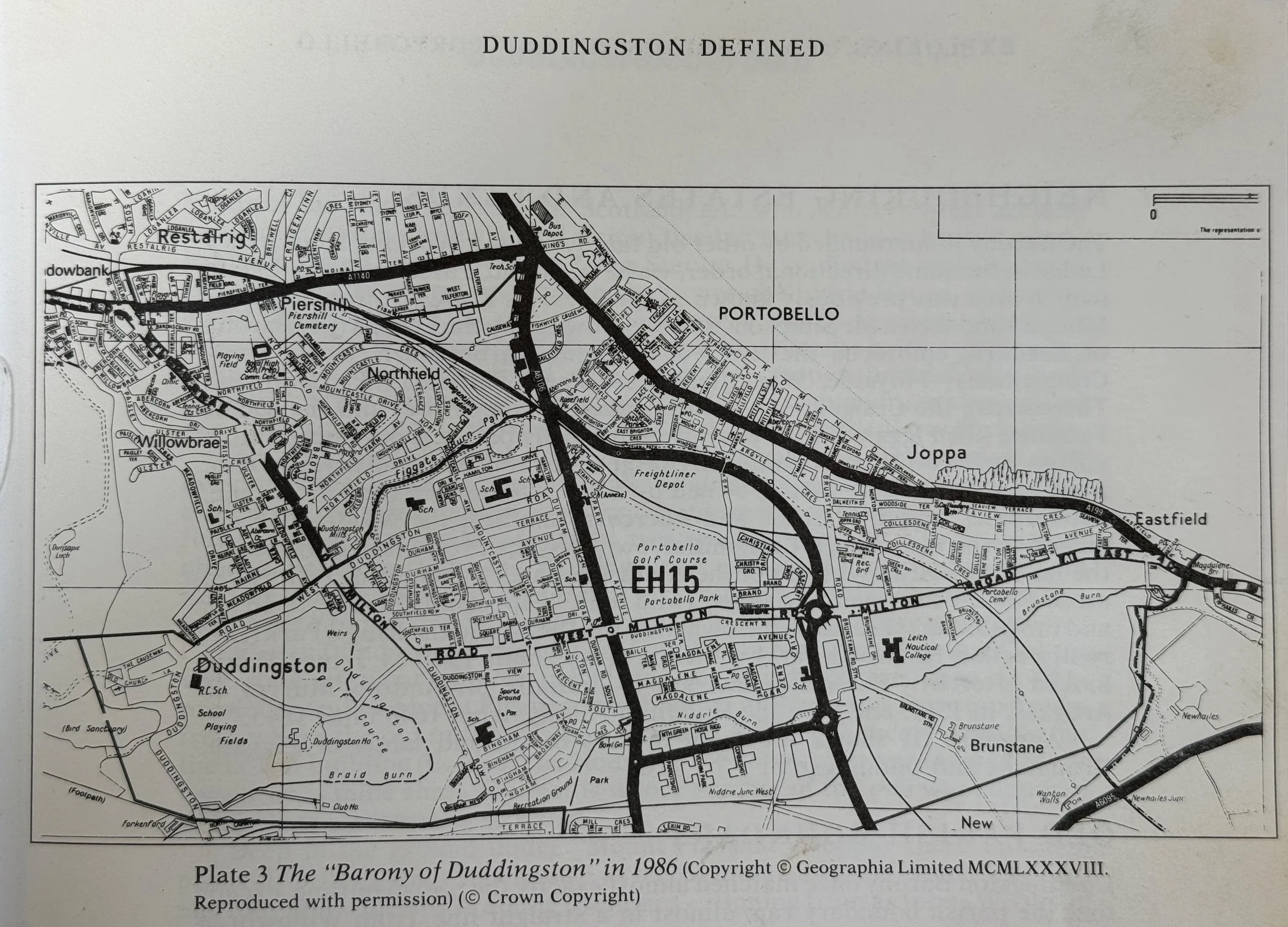
It made me see my own walking route differently. The path to the promenade isn’t just a commute to the sea; it’s a thread laid over older threads. My “Valleys” from Attar sit on top of these earlier systems: roads that carried people before I carried my thoughts, burns that moved before I noticed them, names that survived because someone wrote them down in ink.
I left the library feeling oddly energised—like I’d just been given extra layers to print, stitch, and misread in the best possible way.
What might become cloth:
A small “before Portobello” inset map printed faintly onto wool; an old road structure simplified into thick lines; my own route stitched over the top like a newer hand refusing to erase the old one.